
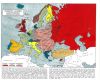
US Presidents with Irish ancestry and the counties they descend from
(Source: reddit.com)
Related Posts
![Ammassalik wooden maps: carved, tactile maps of the Greenlandic coastlines made by Inuit, 1884.
[[MORE]]
Ammassalik wooden maps are carved, tactile maps of the Greenlandic coastlines. In the 1880s, Gustav Holm led an expedition to the Ammassalik...](https://64.media.tumblr.com/dd84045b305144bfd36c9c7a9e2bad53/tumblr_nhp29kU2SU1rasnq9o1_100.jpg)

![Size of Downloadable US State Maps on Nokia Maps App
[[MORE]]KaptainKielbasa:
I know interactive maps are passe, if someone wants to do a mock-up and present all the data in a nice form, I am perfectly fine with that! I’m also going to look at...](https://64.media.tumblr.com/0fcb3d89d4fb9ce8af3c25789b05fd26/tumblr_nj3v6rCwws1rasnq9o1_100.png)

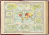
![“Rambles through our country: an instructive geographical game for the young”
[[MORE]]
Shatbird:
From the secret karma treasure Norman B. Leventhal Map Center and the Boston Public Library
Here is the map’s entry including a link to a 111MB...](https://64.media.tumblr.com/6e36f636b7d8853438acc82f9ab9520a/tumblr_nb1o7rLF831rasnq9o1_100.jpg)


US Presidents with Irish ancestry and the counties they descend from
(Source: reddit.com)
 j37h3r liked this
  anxious-skogkatt reblogged this from not-rude-ginger
  caseopencaseshut liked this
  fanboying-ace liked this
  niallsvein liked this
  birchshutter liked this
  jigsawfalls liked this
  navyranveone liked this
  drinkmoremoxie liked this
  lemizerableu liked this
  thornmane liked this
  saml24 liked this
  unprofessionalcat liked this
  theatheistgirl liked this
  septimum liked this
  fractalusurper liked this
  friendlylocalgeek liked this
  thatoneaceumbrella liked this
  obeythefloof liked this
  joanhello2 liked this whitebullone liked this rcl281154 liked this