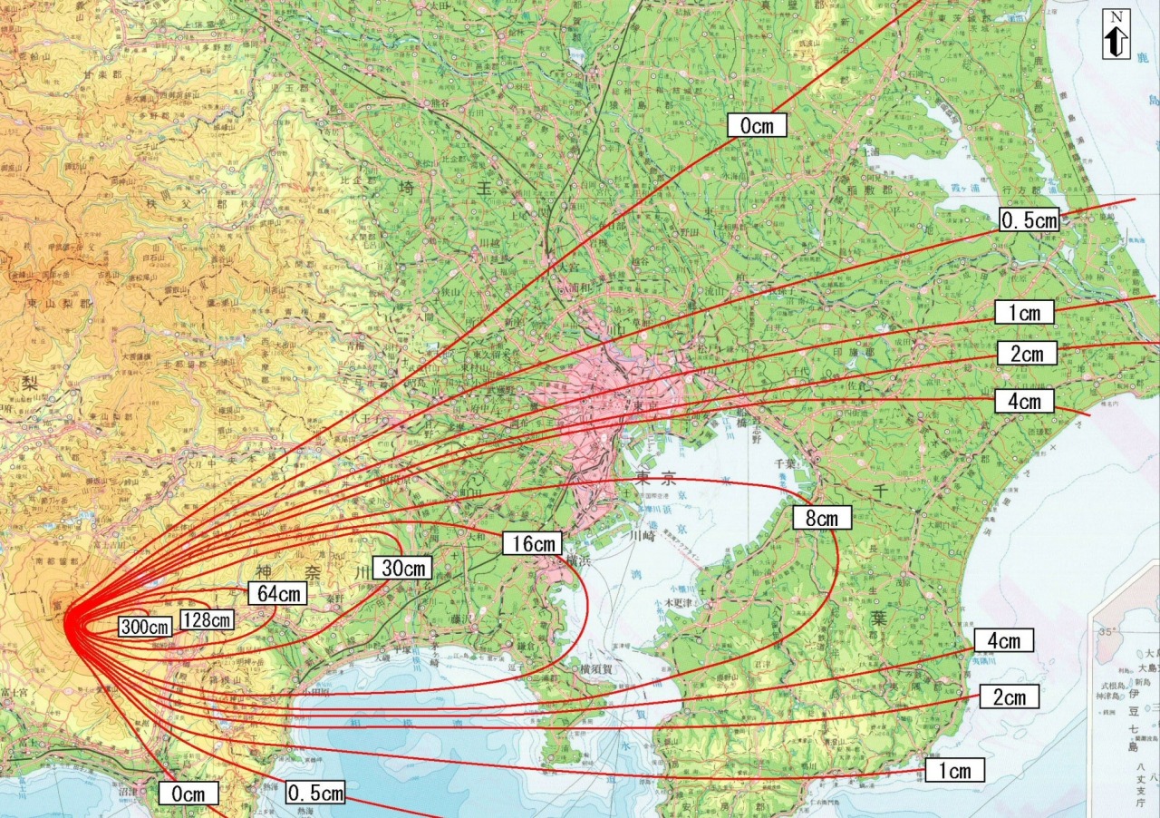
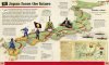
How deep the ash was from the 1707 eruption of Mt. Fuji, Japan.
(Source: Wikipedia)
Related Posts


![Arita Ware map of Japan, 1830.
[[MORE]] wouj:
“Object caption from museum display:
The map on this plate is a Gyoki-style map, so named after the Buddhist monk Gyoki (668-749). Such maps were not made in an attempt at geographical accuracy and show...](https://64.media.tumblr.com/36e4aed7747c78d2fe680eff43283d8f/tumblr_ofulpuo2yX1rasnq9o1_100.jpg)

 nebris reblogged this from mapsontheweb nebris liked this
  cursed--alien reblogged this from mapsontheweb
  puppypeepad liked this
  someone-but-still-noone liked this
  penobscot1731 liked this dirteerat liked this
  cheesemunchy11 liked this
  comfy-introvert reblogged this from mapsontheweb
  banflipflops liked this
  mapstories reblogged this from mapsontheweb
  lilylunagirl liked this
  lakurwa liked this
  ston-rampler liked this
  nervousjellyfishdefendor-0d87c12 liked this
  boogie-woogie-boogie liked this
  johnmit3 liked this
  shadowpuppy2 liked this
  solphage liked this
  so-you-melted-22 liked this
  tuff-dallas liked this