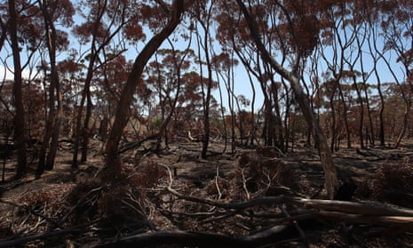
A group of bushfire scientists have used an article in one of the world’s leading scientific journals to call for Australia to establish a national agency to monitor the scale, severity and impacts of fires.
The eight scientists from Australia and Spain say inconsistencies in how the scale and severity of bushfires are measured across the states had led to confusion over how much of the country actually burned.
Analysis of satellite data for the article, published in Nature, shows 18% or 7.5m hectares of the country’s eucalyptus forests burned – a figure 7.5 times higher than the average over the past 18 years of the satellite record, but about 600,000 hectares smaller than government data.
At a time when climate change was driving more frequent dangerous bushfires, the lack of a consistent approach meant “we’re navigating uncharted territory without a compass”, the authors wrote.
The scientists from the University of Tasmania, the University of Wollongong, the Australian National University and the University of Alcalá in Spain, said the ongoing royal commission into the bushfires should recommend a national fire monitoring agency be established.
Such an agency, the group writes, could agree a consistent approach to measuring the frequency, size and severity of fires, as well as investigating their causes, the greenhouse gas emissions they generate and the public health and economic issues they raised.
“The 2019–20 fires marked a historic crossroads. A national crisis of this magnitude, which will probably happen again, requires a national solution,” the authors conclude.
Their own analysis, using only satellite data, showed that 30.38m hectares had burned in the 2019 and 2020 fire season, across all types of land cover. This compared to a government estimate of 39.8m hectares.
Government records often included unburnt patches within a single perimeter, the scientists said, whereas satellite data was more consistent but was also prone to missing fires, particularly those less-severe burning under dense canopies.
“Both approaches have strengths and weaknesses,” the scientists write. “It will thus be crucial to monitor fires with a method that can produce internally consistent data at the national scale, and that can be repeated many times during a fire crisis.”
Without such a consistent approach, the scientists said it was more challenging to assess the environmental impacts of the fires and verify claims.
As many as 3bn animals have been estimated to have been in the path of the fires. Three ecologists concluded that the fires caused “the most dramatic loss of habitat for threatened species and devastation of ecological communities in postcolonial history”.
The lead author of the article, Prof David Bowman of the University of Tasmania, told Guardian Australia the purpose of the satellite analysis was to illustrate how the different approaches could deliver inconsistent results.
“In the eucalyptus forests, there’s no question these fires were unprecedented in the satellite record,” he said.
Dr Grant Williamson, a co-author of the article, also of the University of Tasmania, said he did not think the satellite data used for the article should be relied on either.
He said: “The satellite data can miss low-severity fires. If there’s a fire burning under a dense forest, the satellite can’t pick that up. We need a combination of approaches.”
Bowman told Guardian Australia a more careful record of Australia’s fire history was needed. For example, some official sources have stated that Victoria’s Black Thursday fires of 1851 had burned across 5m hectares of the state, but don’t define what was burned.
A reference used for those reports says only 1.5m hectares of forest burned that year, with the rest being scrub and grasslands.
Adjunct Prof Jim McLennan, a bushfire safety expert at La Trobe University, who was not an author of the article, said he supported the proposals for a national approach.
He said: “Historically, response to natural hazard emergencies, and associated data collection, has been a matter for individual states and territories.
“However, future increases in hazard frequency and severity, driven by global warming, mean that weather-related hazards require a national response capability, and the basis for this must be an appropriate national database.”
Also commenting on the proposals, Dr Michael-Shawn Fletcher, an associate professor at the University of Melbourne, said a nationally consistent approach was “crucial for guiding efforts at mitigation and post-fire response”.
He said satellite imagery was useful for tracking fires in the more open tropical savanna in the country’s north, “but these systems are very different to the temperate eucalypt forests that, arguably, present the greatest risk for Australia’s firey future.”
He also cautioned against moving away from independent assessments of fire area, severity and impacts in favour of a national approach.
He added: “Finally, it could be argued that the solution needs to reach beyond a simple national monitoring agency, to an independent and nationally-coordinated agency aimed at informing government about prediction, mitigation and monitoring of fire in Australia.”
