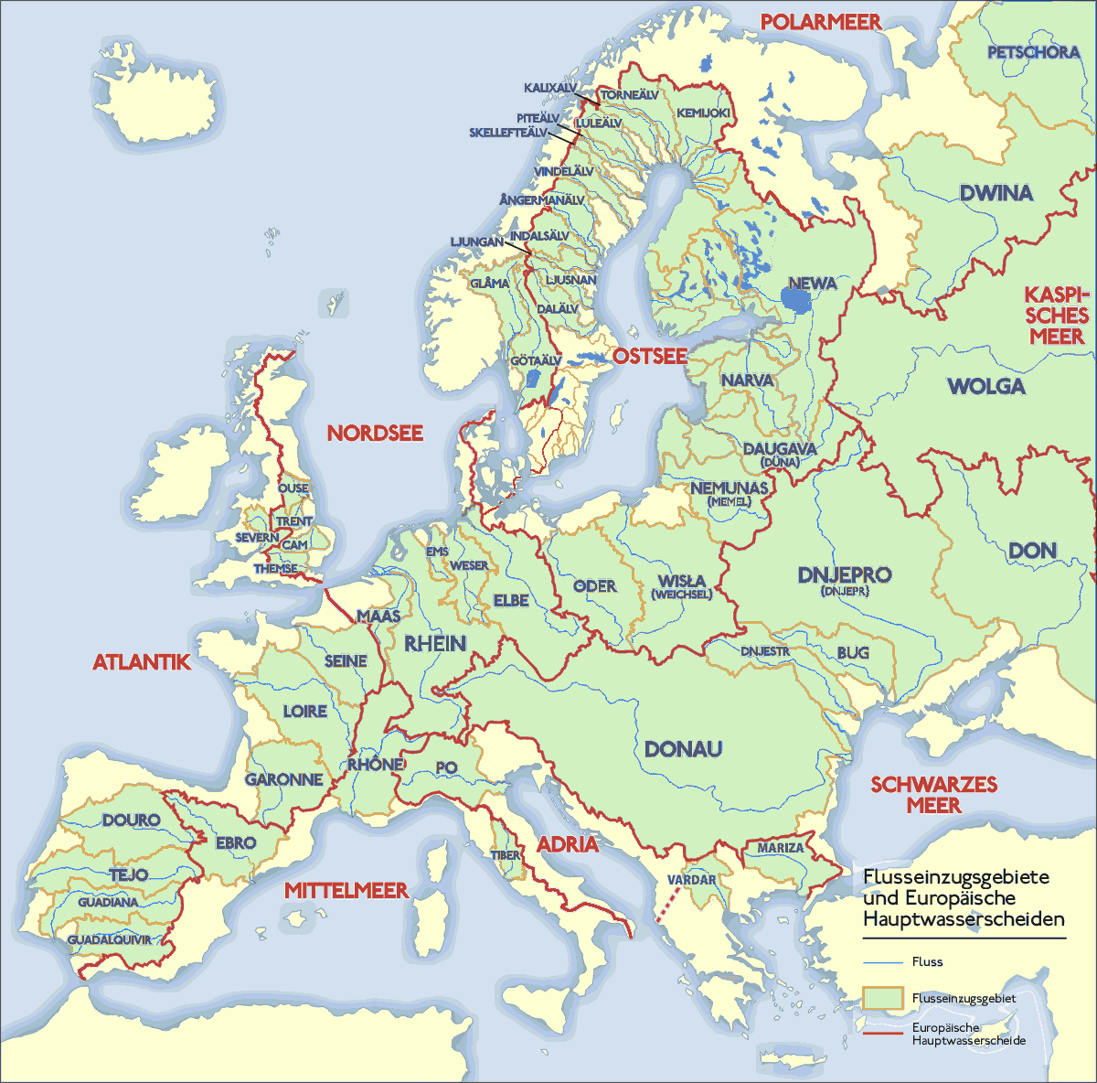
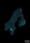
Drainage basins of European rivers.
(Source: commons.wikimedia.org)
Related Posts


 davvero-annoiatx liked this
  mythshotelsrestaurants liked this
  therewillbebeauty liked this
  warrenjones1958 liked this
  artill2 liked this mariner52156 liked this
  rusalkii liked this myniner liked this
  kithlodaeus liked this skullumio reblogged this from mapsontheweb
  doctordearie liked this altroviaggio reblogged this from yoursisnodisgrace altroviaggio liked this yoursisnodisgrace reblogged this from nebris
  tauremornalome liked this
  excuse-my-disdain liked this
  aph-shy liked this
  luxy-amigo liked this teveteve liked this