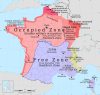
![3 years of war, 1944.
[[MORE]] globalis:
“This map was published in the American newspaper New York Sunday News on december 31, 1944.
Drawn by Edwin L. Sundberg, this map provides a graphic account of the War, with “Outstanding Events” noted on a...](https://64.media.tumblr.com/4d2302d1ed708760d2221d155f3b6f37/tumblr_ourn0h7mml1rasnq9o1_1280.jpg)
3 years of war, 1944.
This map was published in the American newspaper New York Sunday News on december 31, 1944.
Drawn by Edwin L. Sundberg, this map provides a graphic account of the War, with “Outstanding Events” noted on a year by year basis and legend noting the United Nations (the nickname of the Allied nations), Axis nations and Non-belligerent nations, plus the location of Outlying US Naval Bases.
This is one of several Sundberg maps published as Sunday news inserts during the war years. Sundberg was known to have been a pictorial map artist both before and after the war.
Related Posts

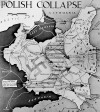


![World War II hand drawn maps
Album
[[MORE]]Key: I did not think of it as being crucial considering everyone knows about world war 2, but here it is:
Blue: Allies
Dark light blue: UK
Light light blue: occupied allied* territory and colonies
Dark dark...](https://64.media.tumblr.com/6dfc7fe94dff8ca251d96dc8365665bf/tumblr_no9blmBmtd1rasnq9o1_100.jpg)