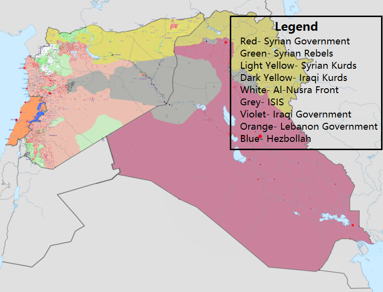
Zones of Control in Iraq, Syria, and Lebanon, as of August 8, 2017.
(Source: commons.wikimedia.org)
Related Posts
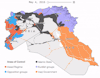
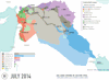
![Iraq-Syrian Civil War in December 2014, compared to October 2017.
[[MORE]]• Red - Syrian Government
• Purple - Iraq Government
• Grey - Islamic State
• Green, White - Syrian rebels
• Syrian Yellow - Rojava (Kurds)
• Iraqi Yellow - Iraqi Kurdistan](https://64.media.tumblr.com/2c37e2d223fe4721aa2750f537c60a45/tumblr_oxgv0oApfA1rasnq9o1_100.jpg)

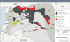

Zones of Control in Iraq, Syria, and Lebanon, as of August 8, 2017.
(Source: commons.wikimedia.org)
 davvero-annoiatx liked this
  no-passaran liked this
  cowboy-catboy reblogged this from mapsontheweb
  mamabulldogg777 liked this
  zumer-feygele reblogged this from portentsofwoe zumer-feygele liked this
  whackbatter liked this
  manateebety liked this hugo0420 liked this iafeh liked this
  britishimperialglory reblogged this from mapsontheweb britishimperialglory liked this
  kasunex reblogged this from mapsontheweb
  plantkat reblogged this from sweethotnight
  aethelredtheunready reblogged this from mapsontheweb
  onelascivious reblogged this from mapsontheweb