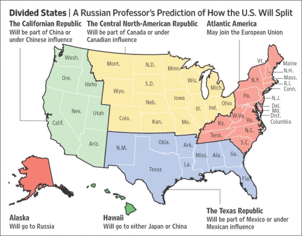
Russian academic Igor Panarin had been predicting in 2008 the U.S. would fall apart by 2010. He thought an economic and moral collapse would trigger a civil war and the eventual breakup of the U.S. - This map shows his prediction on how the U.S. would’ve split.
(Source: The Wall Street Journal)
Related Posts
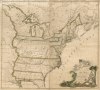
![Alternate history: La Louisiane and her Neighbors in 1906.
[[MORE]]by girthynarwhal:
An older map I made I thought I’d share here while I work on my current two maps. Backstory:
It all stemmed off the idea of the United States not acquiring the...](https://64.media.tumblr.com/659deb4ab9728aa5ee7ac30b8e74e882/tumblr_podrlucHCi1rasnq9o1_100.png)
![Alternative map of the USA,from Aces and Eights.
[[MORE]]An alternate history time line in which the American Civil War happened ten years earlier and the United Kingdom and France assisted the Confederate States of America (CSA). The Civil War...](https://64.media.tumblr.com/5afa25ddd362f1ffeaf75004b4212486/tumblr_prf3o7w4k71rasnq9o1_r1_100.jpg)


![Transportation in the United States - Roads, Railroads and Ferry routes.
[[MORE]]Source: Reviving the Statistical Atlas of the United States with New Data a very interesting project using new data to create old-style atlas maps using only public...](https://64.media.tumblr.com/422f65e4eaa861442cc23f800e209a52/tumblr_nqtx0odpMA1rasnq9o1_100.jpg)
![Population Density of Contiguous United States by Census Block.
[[MORE]]Data source: https://www.census.gov/geo/maps-data/data/tiger-data.html, QGIS
This is literally the lowest geographical area the United States has. There are around 8.3 million...](https://64.media.tumblr.com/27730c938ca01780f146568a533be80a/tumblr_nmprlroOWu1rasnq9o1_100.png)