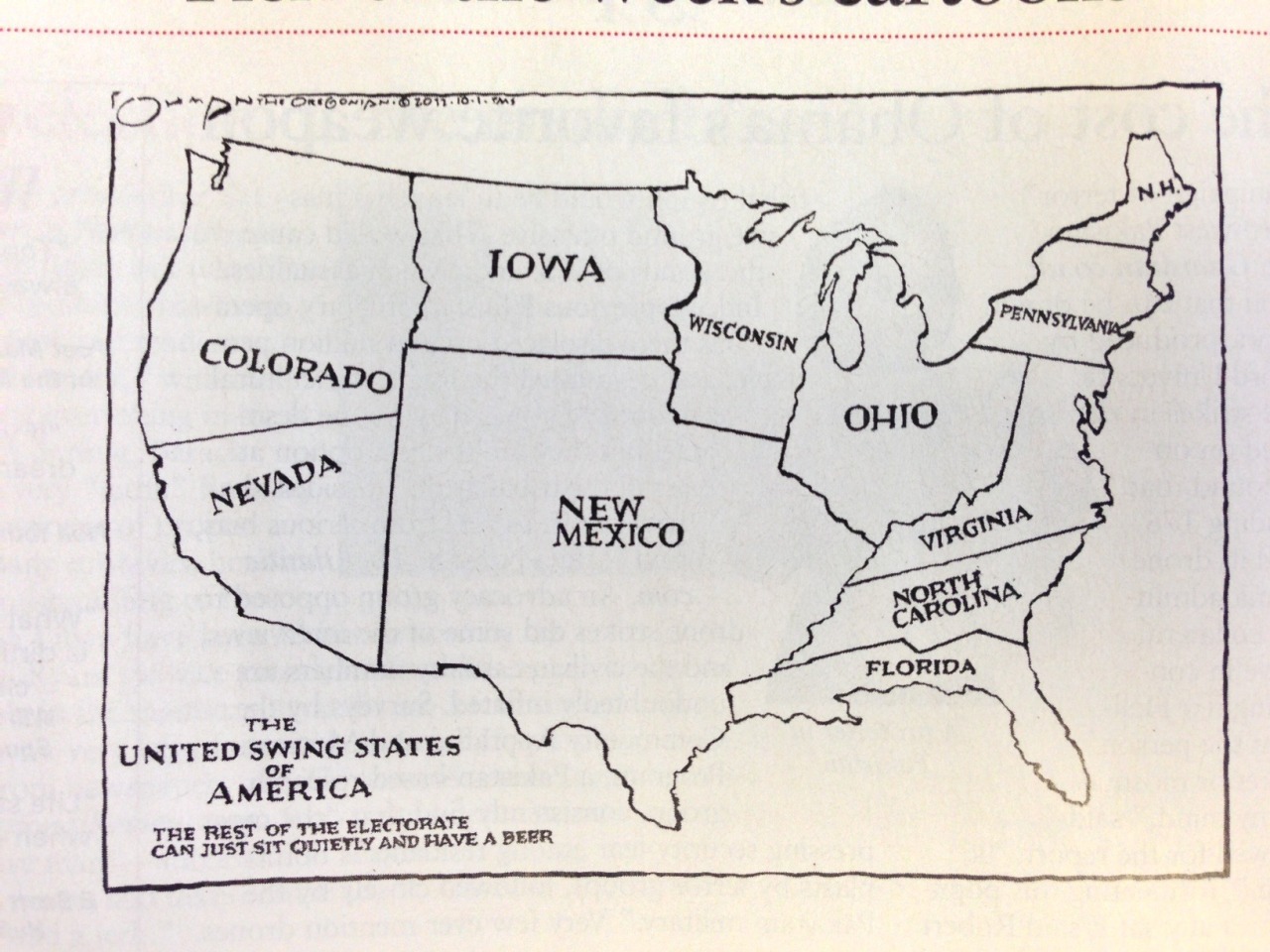
United Swing States of America, 2012.
As shown by this map, the next presidential election will not be decided by 50 states, but by just 11 - the so-called ‘swing states’, that could still go either way.
(Source: bigthink.com)
Related Posts


![United States presidential election, 1924.
[[MORE]]by ProudThatcherite:
Source: https://en.wikipedia.org/wiki/United_States_presidential_election,_1924
Republican candidate: Calvin Coolidge (Massachusetts)
Democratic candidate: John W. Davis (West...](https://64.media.tumblr.com/11fa64e20f2c1bfd1beb75ad81fb20b2/tumblr_p2931hCDB71rasnq9o1_100.png)
![Ancestry map of the United States by county, 2016.
[[MORE]]DPKdebator
“Two years ago I started to work on an ancestry map of the United States with data from the 2016 Census Bureau population estimates via Statistical Atlas, as most of the existing...](https://64.media.tumblr.com/f960bde365e5c95d877cf6f6ec627d42/e55da15e1f15eec5-eb/s100x200/3f124a0c7d9d1e3e630de7e914ec3ec613bb4440.png)
![People were asked to divide the United States into exactly five general regions
[[MORE]] atrubetskoy:
“ This map shows how Americans see the United States divided into five regions. It shows the average of a total 612 responses to the question,
“If...](https://64.media.tumblr.com/422b08773ad0af5c38fd89e3f16a4f71/tumblr_n4ebitmJkX1rasnq9o1_100.png)
United Swing States of America, 2012.
As shown by this map, the next presidential election will not be decided by 50 states, but by just 11 - the so-called ‘swing states’, that could still go either way.
(Source: bigthink.com)
 smiles-should-be-worn-by-all liked this
  lifeaccordingtodrew reblogged this from mapsontheweb
  gen-deer liked this
  landedinlove liked this
 True, hence why in California I’m not wasting my vote on a corrupt lying politician with blood on her hands, despite all...
Reblog for the last comment ^
 wthwilmsfloet liked this
  str8erboi liked this
 Except that anyone following the news is aware that Trump’s massive unpopularity has actually made certain states...
 janvanbrunssum-blog liked this