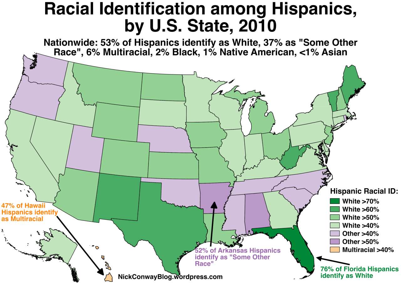
Hispanic Racial Identification by U.S. State, 2010 Census Data
Note: Hispanics are not considered a “race” by the US Census, but instead a “national origin”. So Hispanics can identify as a member of any race.
Source: https://nickconwayblog.wordpress.com/2016/07/24/racial-identification-among-hispanics-by-u-s-state/
Related Posts