Interactive Map Lets You Browse Over 650 Photos Taken by ISS Astronauts
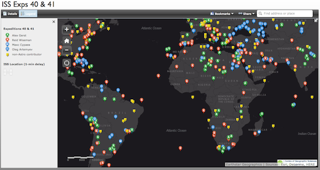
Dave MacLean from the Center of Geographic Sciences has put together a pretty awesome resource for space photography lovers. He’s created an interactive map that lets you browse through over 650 photographs taken by ISS astronauts on Expeditions 40 and 41.
Every point on the map is color coded based on the astronaut who took and uploaded it, and once you’ve clicked on one of the points (Reid Wiseman’s photos are some of our favorites) it’ll pull up a preview that then takes you straight to the original tweet from the astronauts themselves.
For example, here is a photo taken by Wiseman as he was zooming past Trinidad and Tobago:
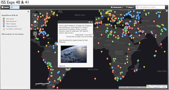
And here’s the original tweet from Wiseman himself:
Have a great weekend. Trinidad and Tobago in the evening sun. pic.twitter.com/zfa89kkJ7C
— Reid Wiseman (@astro_reid) June 7, 2014
If you, like us, love to keep track of the photography sent down from the ISS, this resource is indispensable. Just be ready to waste your entire Saturday clicking on little colored dots and having your life put in perspective if you do visit the map.
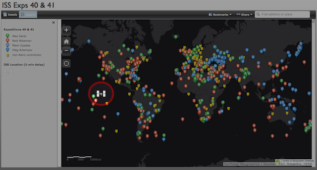
Oh, and the cherry on top of the astronomical sundae? The map also tracks the ISS’ orbit. It’s on a one minute delay, but hey, you can’t win ’em all.
(via Engadget)